Waimangu Volcanic Valley

P1012399
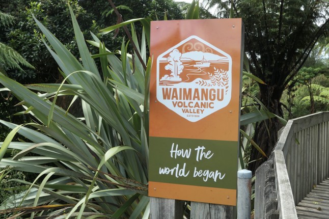
Today we went on a bus and a boat trip and then a hike;to explore the youngest geothermal system in the world.

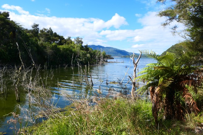
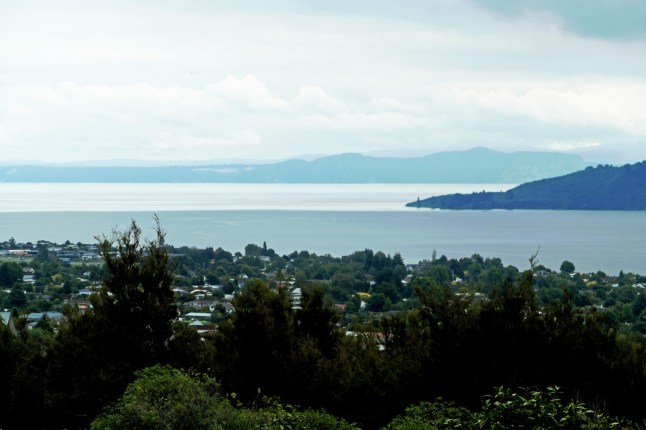
It was a 45 minute drive from Taupo towards Rotorua. If you remember when we were in the Bay of Plenty we came over this way and saw a buried village and waterfall. This is the other side of that lake and right in the huge caldera of the Okataina volcano.

We bought a ticket for both the walking tour and the boat trip. There are buses running down to the lake Rotomahana and back up to the cafe at Waimangu. You have the choice of 3 stops to walk to to catch the bus. So the way we did it…. First we took the bus all the way to the lake and boarded the boat. We were the only passengers! Then after the boat trip we got on the bus and returned to the top for lunch. Then we walked all the way down to the lake and bussed back again. Phew!

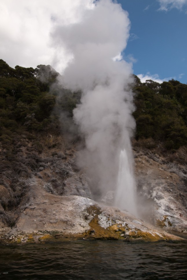
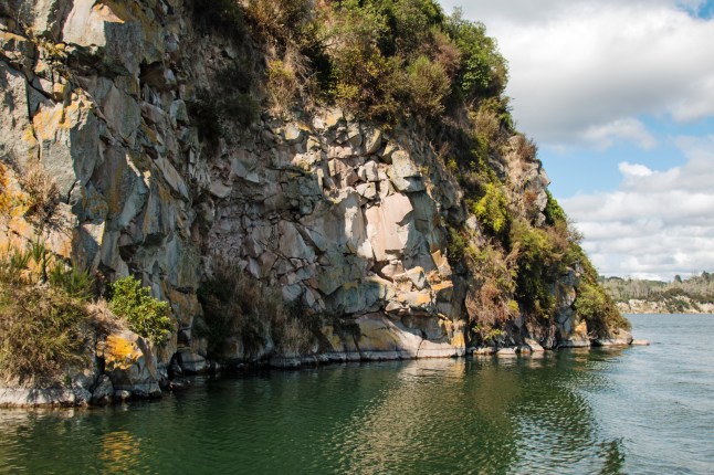
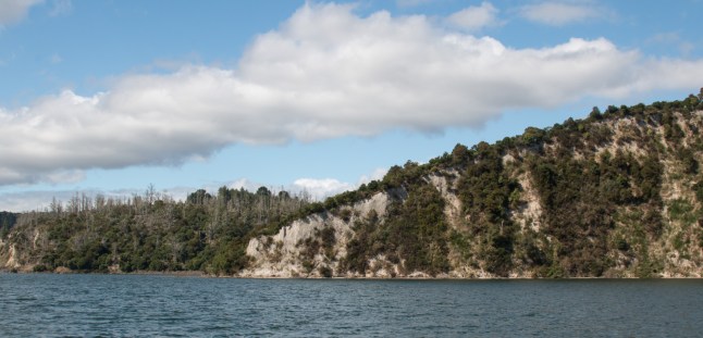
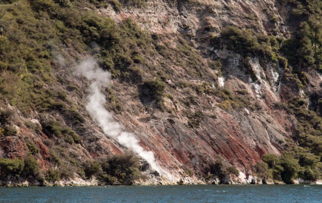
So first the boat cruise around Lake Rotomahana:

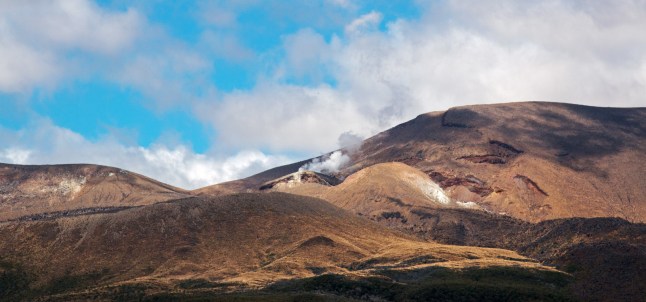
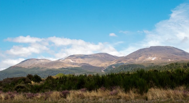
We were in the Taupo volcanic zone part of the New Zealand Pacific “ring of fire”. The molten rock is only a few kilometres below the surface. The whole area was born from and dated from the volcanic eruption within Mount Tarawera. On 10th June 1886. At this moment the lake grew bigger, the area was covered with mud and many people died. New springs of boiling water appeared and sadly beautiful pink and white salt terraces were destroyed for ever.

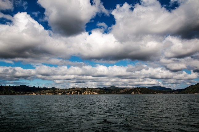
On the lake we saw hot streams, volcanic rock walls of many colours, steaming cliffs, fumerole steam vents and geysers.IMG_0464IMG_0454IMG_0417IMG_0401IMG_0377IMG_0366IMG_0361

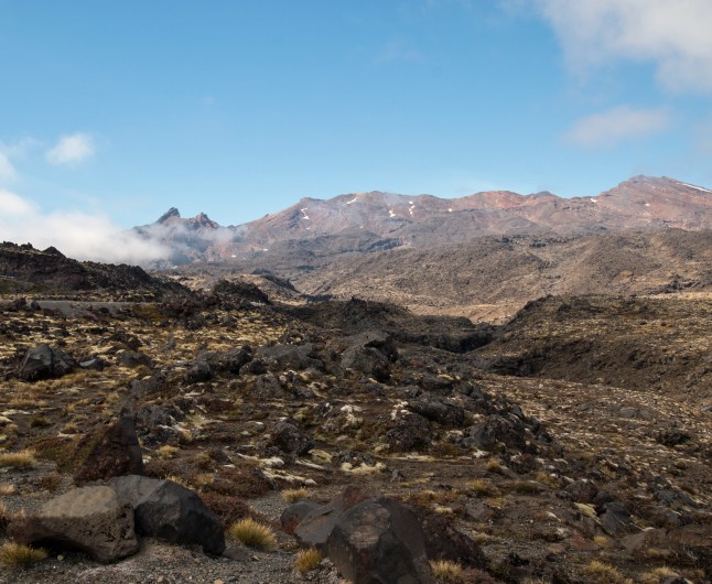
Next the hike down the mountain:

Walking steeply down to the lake, we saw the whole area of the mountain with craters and pools of differing colours due to the algae, a crystal wall and terraces, geysers, bubbling springs of boiling water, creeks and stalagmites, Rift Valley and wetlands surrounding the lake.P1012391P1012400P1012403

P1012469.JPG 
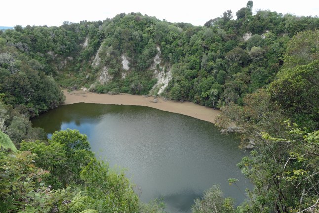
5.3kms is the distance we walked. The geology was spectacular.

We both really enjoyed the whole day. It came to about £36 each( $70 for seniors).For both the walk and cruise. Not too bad for all we saw was it?

Hope you like the photos It has been an amazing day xxxx

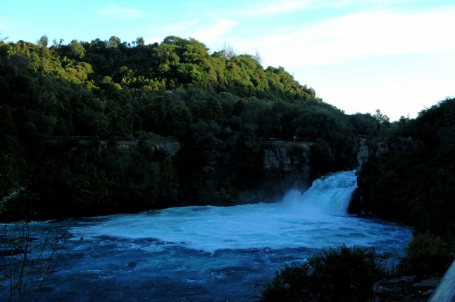
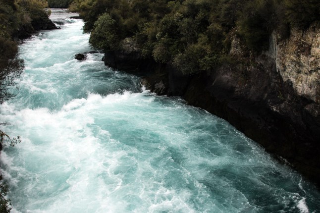
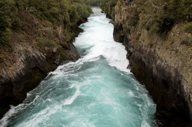
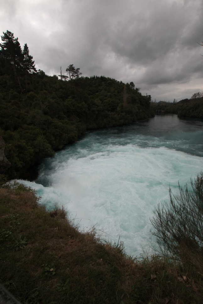
I’ll end with the Huka waterfall and Taupo, We went there again last night and did a bit of the walking tracks along the river down to the falls.
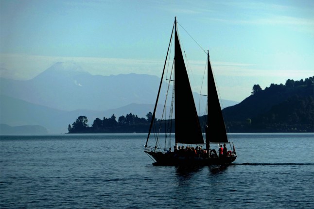
P1012332P1012337P1012339

Volcano land, all around Lake Taupo and Whakapapa ski field.

Such a sad day in New Zealand today after the reality of the massacre in the 2 mosques in Christchurch is found out.

Our hotel is next to the Islamic Centre in Taupo. As we set off there were already several bouquets of flowers outside. When we returned there was a garden of tributes laid there.P1012330

We travelled round the east side of the lake and on route 47 to Whakapapa ski field. We were here 3 years ago and then we went up the ski lifts right to the top of the volcano. This year it is no longer in operation. There are major works going on up there in the ski village and improvements being made and no ski runs. The visibility wasn’t too great this morning but I managed to get a few shots of the volcanic rocks and skylines. It is a bleak but fascinating environment. The vegetation gradually dies away as you ascend up the road.IMG_0354IMG_0352IMG_0337

Do you like the steaming hillsides?

We went to the visitors centre in the National Park and then called back at Turangi. (We stayed at Turangi 3 years ago)

Back in Taupo there are lots of sports and races going on. Yacht racing and Ironmauri.P1012329

Many many motorbikers passed us on the way round the lake. That was scary…… and noisy! Is this a Saturday thing I wonder?

Before I stop writing I forgot to show what we met on the road over to Taupo from Napier. 2 houses being moved along the road ….incredible!

.

.

Arrived at Lake Taupo

We left Napier this morning. We feel much better. Mann Tours back on track….

The journey from Napier to Taupo follows the highway 5 along the Thermal Explorer Highway. We travelled through the Tarawera forest where we stopped for coffee at Tarawera. This is the half way point along the road too. We loved seeing the hill ranges all along. It is a pretty, and long, hilly road. After Rangitaiki you reach a plateau with volcano hills and steaming hillsides. Then you see a view of the huge Lake Taupo.

We had an early brunch and a rest. There was an arboretum close by with views over the town and lake so we spent some time there and had a little walk along the lemon tree walk.P1012290P1012291

We looked on the map and found that Huka Falls was quite near so we went there. Wow it was impressive. There was a viewing platform and then further along the road you can park up and walk a short way to cross over the river below the falls.

The water flowing over the rocks sounds terrifically loud. It is absolutely worthwhile going to see. It is all fenced off for safety and there are cycle and walking paths along the river and towards Taupo.IMG_0271IMG_0282IMG_0290IMG_0300IMG_0304

About 200,000 litres of water plunge nine metres every second. On the way back to Taupo there are thermal springs and the water is carried along in huge pipes to geo thermal power generation plants.

Our motel is a five minute walk away from the main shopping area and the town is full of restaurants and shops.

Early evening we walked down to the small harbour and beach at Taupo. We found they are doing the kiwi version of IRONMAN….. Ironmaori. The bikes were all there in readiness and swimmers were being timed for the swimmingP1012303P1012313

We are here until Tuesday.

And…. I’m in heaven in our bathroom is our own washer and a tumble drier…. I’ll be washing clothes every day…. it doesn’t take much to make me happy…

Pleased to hear Matthew Blandine Louis and Alice are coming to stay over Easter and Louis staying for a week by himself afterwards, how lovely xxxx

Ps   You will have heard the terrible news of murders at the 2 Christchurch mosques this afternoon. Hundreds of children were in the centre of the city too demonstrating about climate change. Their parents must also be so worried . New Zealand is in shock.

Around Napier Area NZ

P1012274Today our last day in this area we didn’t do that much. We explored the town and shops and had a coffee break. P1012276P1012277P1012279P1012282

Then we went down the Marine Parade and stood on the small jetty in the sea.

Next we went to the coastal reserve we visited yesterday ……


and then onto a honey visitor centre! Arataki honey opened in 1944 It is in Havelock North and has free entry and tastings.

We learnt all there is to know about bees and bee keeping. There were bees in hives to see. We tasted 8 different kinds of honey.

Blue borage and Manuka honey were our favourite. They all had a slightly different taste. Of course there was a shop selling everything bee, honey and beeswax related. It was a good place to visit.

Tonight we walked along the historic harbour near our motel. Hope you like the pics.

IMG_0254IMG_0263IMG_0264IMG_0270

Dad and I have not been feeling too well since we visited the gannet colony. We’ve picked up a virus like flu. Can you catch bird flu so quickly? Only joking! So we haven’t explored so much as usual. Hopefully we will feel much better tomorrow as we travel inland onto Lake Taupo. We are staying at the lake for 4 nights.

More news tomorrow xxxx love to my beautiful grandchildren, missing you xxxx

Art Deco Napier

317A8124
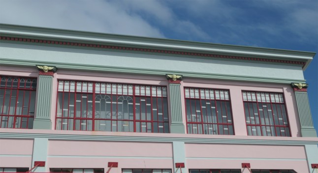
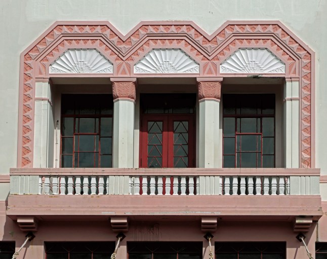
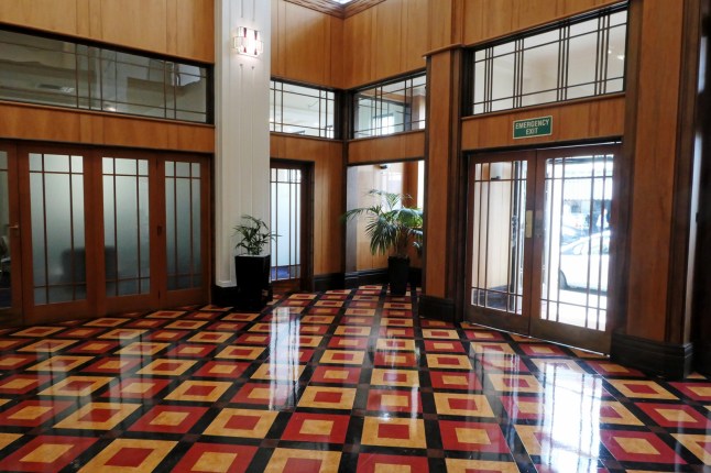
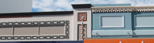
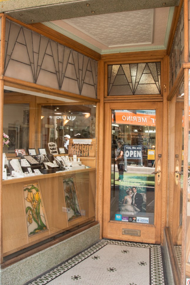
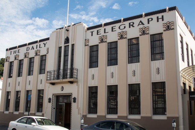
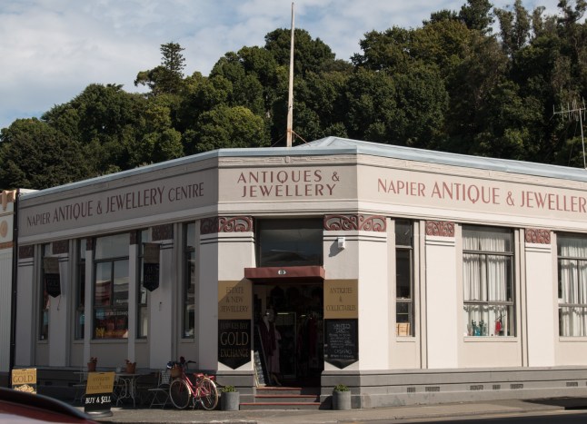
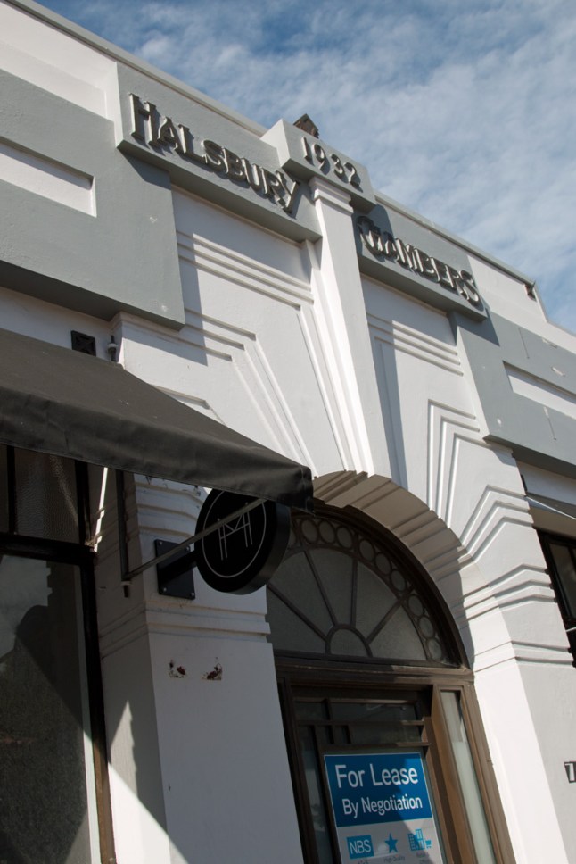
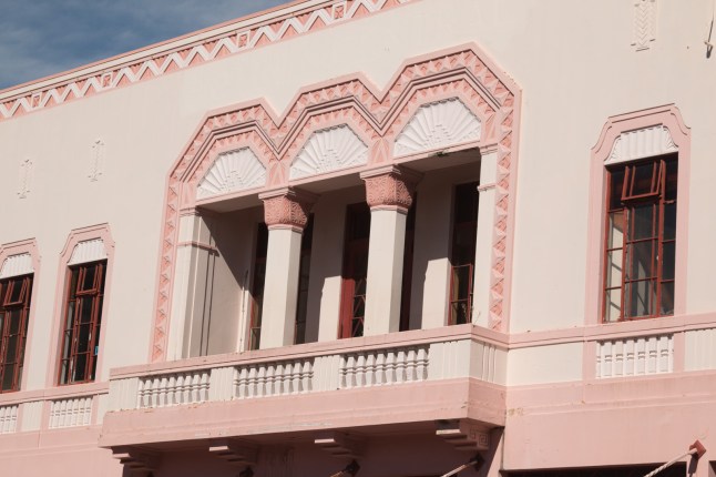
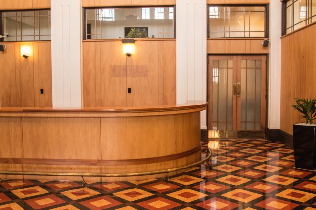
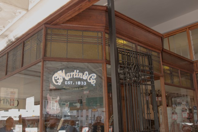
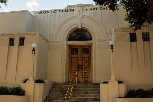
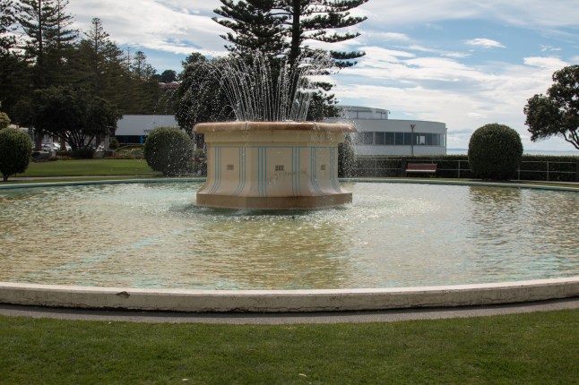
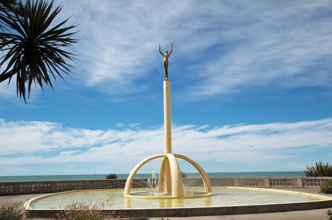
Today we went to the Art Deco centre and joined a group to tour the town.

It started off with a half an hour long video all about the town just before the 1930s earthquake, the actual earthquake and immediately afterwards. There were stills and videos of everything and it was very interesting. Then our guide took us around the main streets pointing out Art Deco of shop facades and interiors. We viewed the inside of a few times of the buildings too.

Here are some of the many photos I took….IMG_0077IMG_0078IMG_0081

IMG_0094IMG_0101IMG_0103IMG_0110IMG_0117IMG_0132IMG_0141IMG_0155
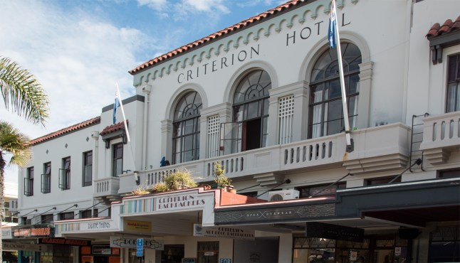
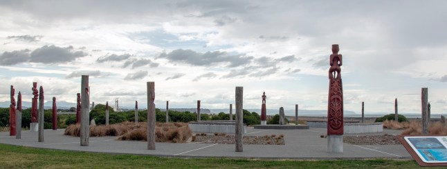
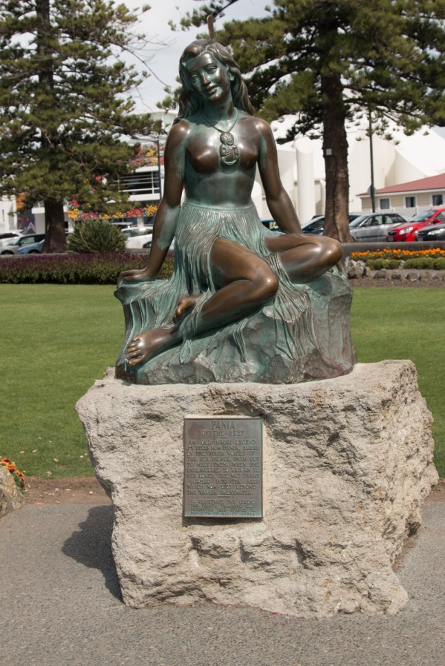
Afterwards we sat outside a cafe in the shade. 29*c today and humid.

We knew there was an amazing viewpoint not to miss beyond Hastings above Havelock North called Te Mata Park. So that’s where we went to next. 399metres high with views over Heretaunga Plains and Hawke’s Bay including Napier.

The views were 360* and the road goes right to the top of the cliffs. We parked up just short of this. There were different walks to do but not today. It is too hot and they are really hilly.IMG_0177IMG_0187

Back along the coast we stopped at a wetlands reserve. There is a Maori compass marked out to follow where the stars rise and set in the sky, along with Maori carvings too. IMG_0206

There were not many birds out there today but sometimes there are spoonbills so we must go back before we leave.

It is raining on and off now but it’s supposed to be very dry and hot again tomorrow.IMG_0160IMG_0161IMG_0170

This sculpture is called the Spirit of Napier

Gannet Colony Te Awanga, Hawke’s Bay.

IMG_9885
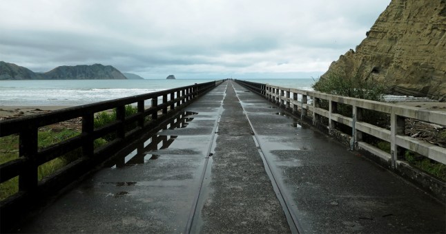
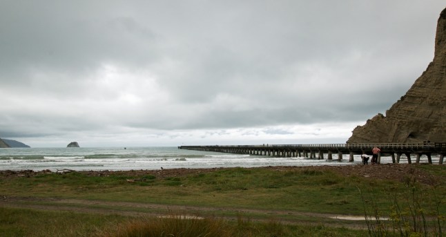
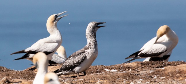
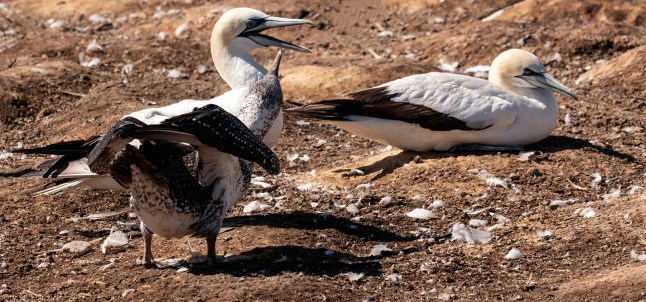
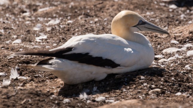
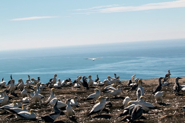
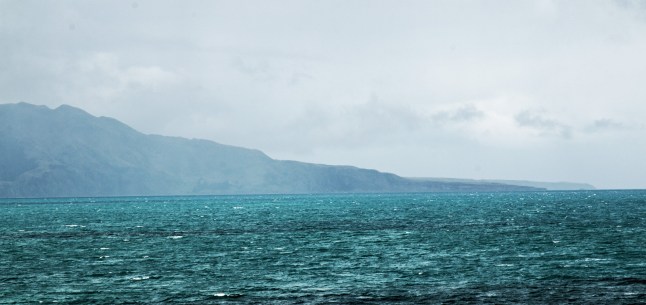
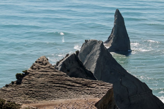
Today we travelled to the gannet colony at Cape Kidnappers, Hawke’s Bay

Gannet Safaris are based in Te Awanga and we left our car there and went on their mini bus to the Gannet Colony.

You travel 7 miles over private farmlands to reach the colony. Our driver, Graham told us all about the history of the land we travelled over; from when Captain Cook named the cape Cape Kidnappers to present day. It was so interesting to hear about the families who had owned and worked the land. The present owner is a billionaire who has created a top class golf course up there with accommodation and facilities costing mega bucks to stay there.

The road is tarmacked up to the golf course but gravel there after. The land is covered in steep gullies and hills. The bus climbed along scary bends with very deep drops. We stopped to view the coastline at the top of the sheer cliff. A very recent cliff rock fall has closed the beach to the public. You could walk 5 miles to the colony along the beach, up to January this year, then they had to stop this for safety. So now the only way to get to the gannet colony is by Gannet Safari buses.IMG_0043IMG_0050IMG_9801

There were 3 colonies. You could see the other 2 in the distance. There were so many birds and chicks. It was noisy and very smelly. It was difficult to get good shots as you couldn’t photo individuals and they were moving so much. Anyway here is a taste…IMG_0004IMG_0016IMG_0012

We enjoyed the whole morning it was so entertaining.

After lunch eaten near the closed off beach we went to the motel for a rest. Since then we’ve popped into Napier and wandered along the sea promenade. Tomorrow we are going to see the Art Deco buildings in town and explore inside some of them.P1012261P1012250

Hope the weather is getting less windy now for you, pleased we missed that. Xxx

Arrived in Napier

As we left Gisborne this morning it was bright sunshine, the rain almost gone….

This is a butchers shop I just had to photo before we left.thumbnail_image1

We had set off early and decided to revisit the Mahia Peninsula on route to Napier. The skies were brighter but the tide was in so not much rock pavement was to be seen. We still enjoyed the scenery though and went as far as the gravel roads.IMG_9769IMG_9777IMG_9778IMG_9782IMG_9784IMG_9789IMG_9795IMG_9800

After we passed the Wairoa lagoons we stopped for lunch at a cafe near to Mohaka…. I’d had enough of Wairoa pancakes 😉😏!

Mohaka has the tallest viaduct in Australasia. The road passes underneath it. There were no opportunities to stop and take a photo, sorry. We passed very steep valleys and gorges and cliff faces. The road wasn’t too difficult though and seemed to follow ridges with views either side and in through valley bottoms.

We are now in Napier and quite close to the sea and beach, port and wetlands all close by. The mosquitoes have already bitten me they didn’t take long to find me. I thought we’d got rid of biting insects!

Tomorrow we are going on a trip to a gannet colony, that will be different!

Hope you are all doing well and can’t wait to see you all soon xxxx

Mahia peninsula part 2

Here as promised are some of Grandads pictures of the dramatic coastline and weather we saw today . The peninsula is south of Gisborne and between Poverty Bay and Hawkes Bay. It was quite an experience! In one part some of the road had fallen into the sea….317A7647317A7650317A7651317A7658317A7661317A7664317A7672317A7677317A7680317A7684

Mahia Beach and Mahia Peninsula

Look at the stormy skies we woke up to today! Nevertheless we carried on with our plans to explore the coast south of Gisborne. First we stopped for a coffee break by some hot springs at Nikau. It was raining all the way , then we travelled to Wairoa as visibility along the coast was nil! We arrived at Wairoa in the pouring rain and found the famous pie shop. We chose pancakes again! But no bacon or ice cream this time! 3 pancakes, fruit, banana and maple syrup with cream. So still very naughty and filled us up.The rain was gradually easing but the skies looked fierce. We risked going to the Mahia Peninsula and these are some of my photos.IMG_9724IMG_9725IMG_9727IMG_9732IMG_9733IMG_9745IMG_9758IMG_9761IMG_9763IMG_9767P1012207P1012211P1012212
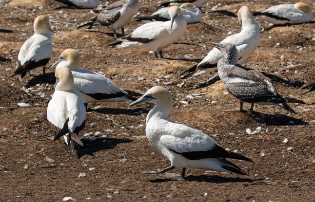
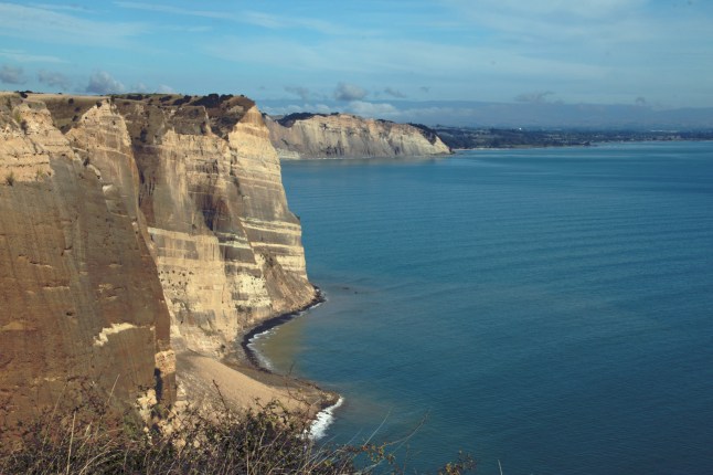
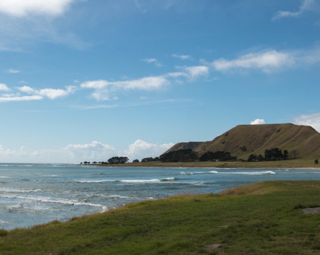
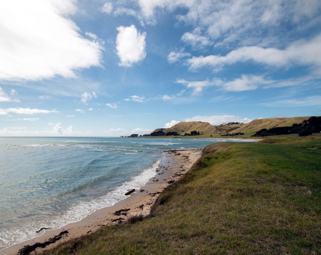
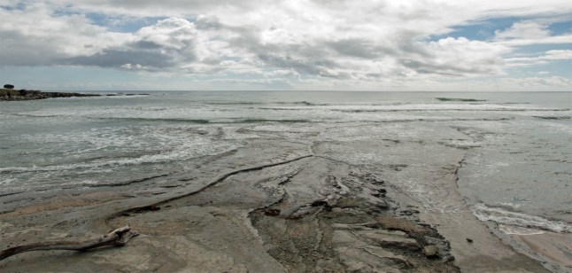
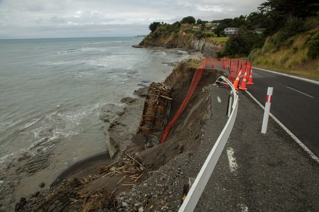
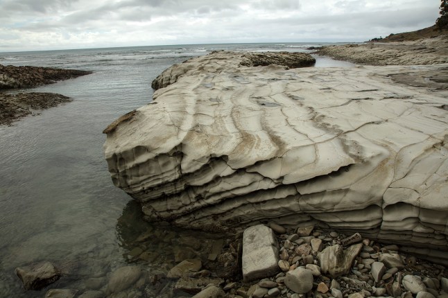
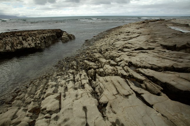
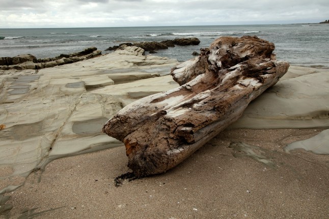
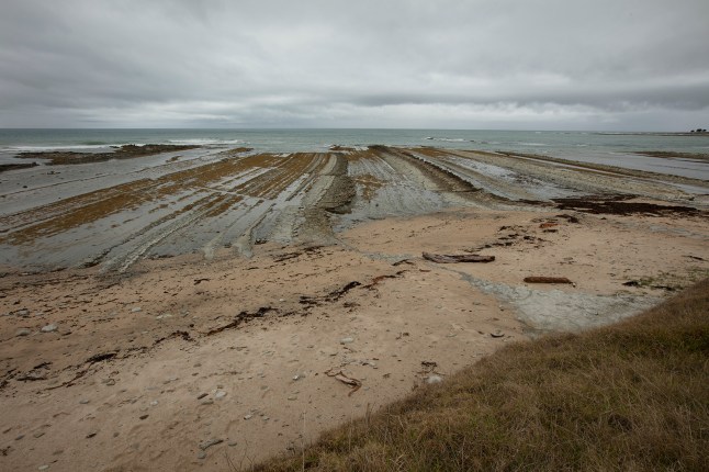
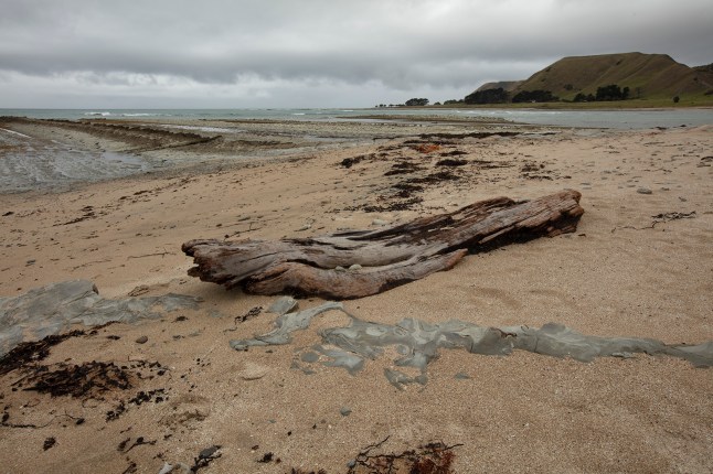
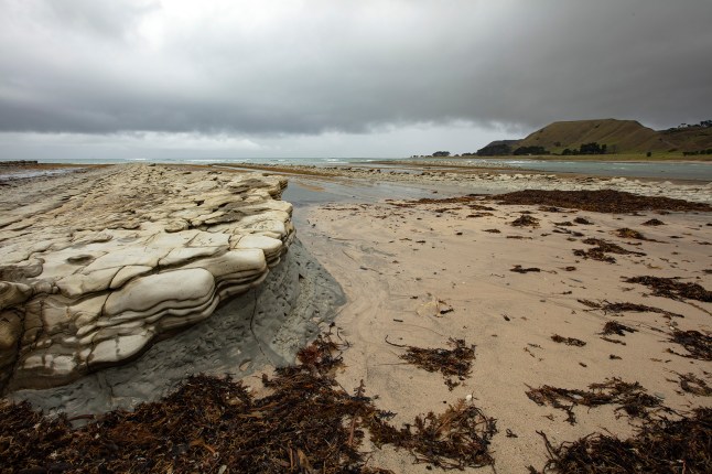
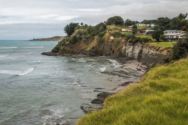
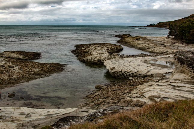
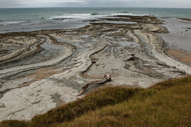
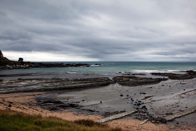
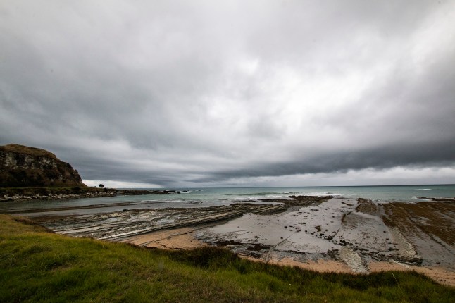
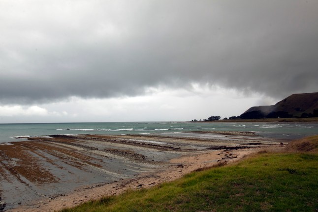
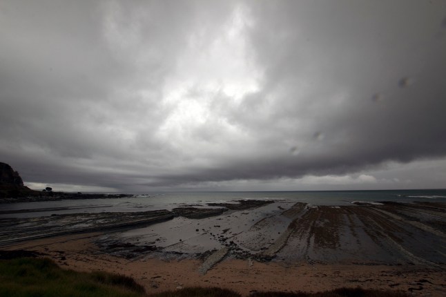
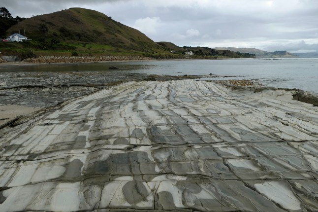
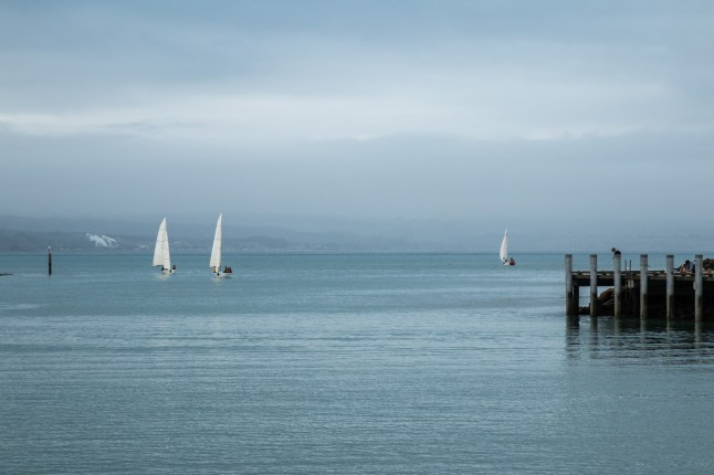
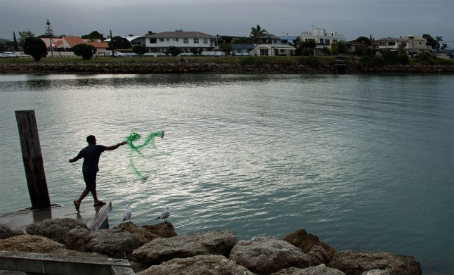
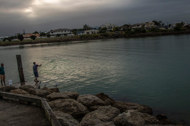
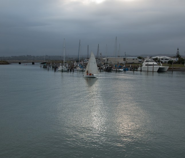
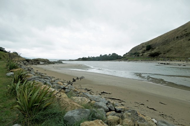
On the beaches are a pavement of rocks and sand. There are lots of little coves and a harbour.

Do you know there were lots of beautiful Paua shells and other large shells everywhere. I was in heaven! My suit case will have to accommodate them!

At the end of the peninsula space rockets are launched! Yes it’s true! A gravel road leads to the end but we didn’t go because the weather was too bad to attempt it.

Last day here, onto Napier tomorrow. It should have stopped raining by afternoon tomorrow

Hopefully xxxxxx

PS Grandad has some fab photos of the rocks, coastline and the state of the road so I’m going to publish his too later (when he resizes and sorts them)    🙂

Rained all night, Gisborne

P1012193
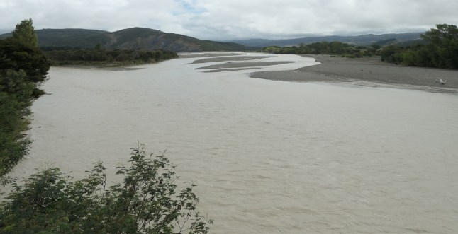
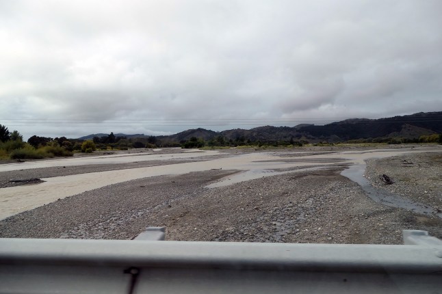
The rain started late afternoon yesterday and came down like a monsoon all through the night. Tin roof does not help to aid sleeping! It has rained most of today too, but not so violently. We have heavy grey skies but we set out for the day, what’s a bit of bad weather? We have seen so little rain since January.

We returned to the road out to the north and East. Today we reached Rangitukia, just beyond Tikitiki. Here there is a Waka ( Maori decorated long canoe) in a meadow. You can only view it from the gravel road.

P1012191P1012189
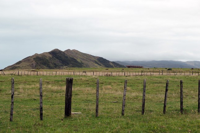
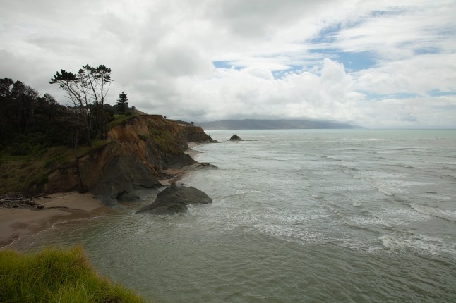
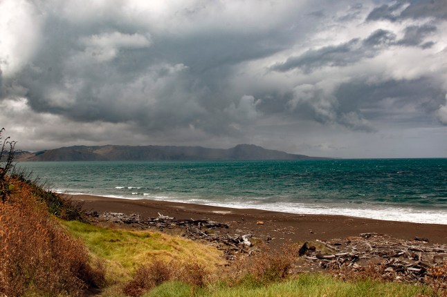
Rangitukia is the most easterly point of the world that we have ever or will ever set foot on. The East Cape is the first area in the world to see the sunrise each new day.

We saw the Tolaga Bay Pier again. this time is was high tide and grey skies so we photoed it to compare with blue sky photos from Thursday. Some old couples were having a snack at the picnic tables sitting under large black umbrellas!P1012185IMG_9706

I haven’t taken many pics today but we have had good fun. We drove round a bend and came face to face with a little pig, black faced white body in the middle of the road. Next we passed a field with a goat herd in it, there must have been 80/100!

We have seen groups of turkeys along the roadside and also puketo birds on the verges. no rainbows today though.P1012194P1012192

We hoped to see HIKURANGI a sacred mountain,a volcano, but at1754m it was covered by cloud sadly.

Back in Poverty Bay ie Gisborne it is pelting down with rain again. So we are chilling out in our motel.

Last night we had 32mm rain and we are having more rain tomorrow, our last day in this area.317A7631317A7632